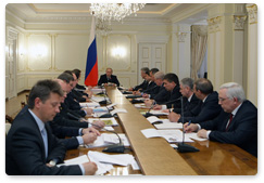
Prime Minister Vladimir Putin chairs a meeting on map support for GLONASS
6 april 2010
Vladimir Putin
At a meeting on map support for GLONASS
Participants:
“The development of GLONASS is shaping acreating serious demand for new technology and the modern intellectual products, <…> it is fundamentally changing changing in principle the practice of economic management, enhancing increasing efficiency in transport, agriculture and even housing and utilities, and granting providing a wide range of of in-demandpopular services for to the public.
The system is acquiring becoming increasingly importantce in the sphere of security.”
The system is acquiring becoming increasingly importantce in the sphere of security.”
Vladimir Putin's introductory remarks:
Good afternoon,
Today we will discuss map support for the GLONASS global positioning system as well as the overall prospects of this major innovation project.
As of right now, only two countries in the world have managed such a complex feat - Russia and the United States. We started this work at the same time as our European partners and outpaced them somewhat. However, our partners have considerable competitive advantages, especially in microelectronics and the ability to commercialize these kinds of projects. Now is not the time to relax. We must keep up the pace.
Of course, further development of the global navigational system will remain one of our top priorities.
First, the development of GLONASS is creating serious demand for new technology and modern intellectual products. Second, it is fundamentally changing the practice of economic management, improving efficiency in transport, agriculture and even housing and utilities, and providing a wide range of popular services to the public.
The system is becoming increasingly important in the sphere of security. Experts understand perfectly well that the development of precision weapons is impossible without a global positioning system. Its even helps the Ministry of the Interior significantly increase its hot pursuit crime detection rate.
Regional and municipal governments are starting to appreciate the advantages that using GLONASS brings. However, I'd like to emphasize that this process must become much more intensive at the local level. The goal is to use the domestic navigation system on a mass scale. This is also important for the project's commercial prospects. Without this it will be difficult to develop the system at all.
Many of our foreign partners have expressed interest in GLONASS. We have signed a number of international agreements on cooperation in this sphere, which is only natural. We continue to actively build up our satellite group, which consists of 23 spacecrafts. Out of this number, 21 are operating flawlessly. There is some room for improvement in the two others.
We are planning to launch another seven spacecrafts by the end of this year: six GLONASS-M and one GLONASS-K with improved capabilities. In other words, by the end of the year we will have at least 27 to 28 permanently operating spacecrafts. GLONASS will reliably cover the entire planet and the system will become truly global.
Obviously, for the system to become fully operational, in-demand and really popular, first of all, in the commercial market, we must actively develop its ground-based component, enhancing the quality of receivers and software, including an array of maps.
There are some difficulties with this. These difficulties arise despite consistent and ample funding.
Let me remind you that 6.6 billion roubles have been allocated for these purposes in 2002-2011. In 2009, we spent almost 2.5 billion roubles. We plan to spend two billion roubles in 2010 and another 1.7 billion roubles in 2011.
Regrettably, the development of digital maps for GLONASS has been unacceptably slow. The only maps that have been compiled are so-called basic maps, which do not contain all the information that customers need. Navigation maps are designed to give a clear, accurate and real picture. They should show the layout of cities and villages, railways, roads and other infrastructure. Moreover, modern navigation maps should cover the country's entire territory. Only in this case will GLONASS operate at peak performance.
We need to develop an exhaustive array of maps both for special and ordinary users. At least 80% of the maps for civilian users must be ready by the end of this year.
I'd like to single out several issues that warrant special attention.
We need to develop a clear procedure for cooperation and delineating the powers of government bodies, the federal mobile operator and commercial producers regarding the development and use of maps. We also need to come up with a way for them to share information.
At this meeting, I'd like representatives of Roskosmos and the Ministry of Regional Development to give their opinion on these issues and make proposals.
Furthermore, as of right now there are no unified requirements for digital navigation maps. I'm referring to the basic and federal maps as well as the maps of GLONASS users.
The successful resolution of this problem is of great practical importance. If we fail to develop a uniform approach for resolving these issues, the customers may be forced to use incompatible maps, which will complicate all the work under this programme.
Let's start our discussion.